


Crossroads Voting District, Rankin County, Mississippi
About
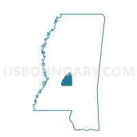
Outline

Summary
| Unique Area Identifier | 606548 |
| Name | Crossroads Voting District |
| County | Rankin County |
| State | Mississippi |
| Area (square miles) | 16.68 |
| Land Area (square miles) | 16.67 |
| Water Area (square miles) | 0.01 |
| % of Land Area | 99.94 |
| % of Water Area | 0.06 |
| Latitude of the Internal Point | 32.25929330 |
| Longtitude of the Internal Point | -89.76473280 |
Maps


Graphs
Select a template below for downloading or customizing gragh for Crossroads Voting District, Rankin County, Mississippi


Neighbors
Neighoring Voting District (by Name) Neighboring Voting District on the Map
- Antioch Voting District, Rankin County, MS
- Cooperville Voting District, Scott County, MS
- Pelahatchie Voting District, Rankin County, MS
- Polkville 77 Voting District, Smith County, MS
- Shiloh Voting District, Rankin County, MS
Top 10 Neighboring County Subdivision (by Population) Neighboring County Subdivision on the Map
- District 4, Rankin County, MS (29,684)
- District 3, Rankin County, MS (26,349)
- District 3, Scott County, MS (6,119)
- District 4, Smith County, MS (3,602)
Top 10 Neighboring Place (by Population) Neighboring Place on the Map
Top 10 Neighboring Unified School District (by Population) Neighboring Unified School District on the Map
- Rankin County School District, MS (117,773)
- Scott County School District, MS (19,782)
- Smith County School District, MS (16,491)
Top 10 Neighboring State Legislative District Lower Chamber (by Population) Neighboring State Legislative District Lower Chamber on the Map
- State House District 74, MS (35,304)
- State House District 60, MS (30,191)
- State House District 77, MS (24,592)
- State House District 75, MS (22,303)
Top 10 Neighboring State Legislative District Upper Chamber (by Population) Neighboring State Legislative District Upper Chamber on the Map
- State Senate District 20, MS (68,638)
- State Senate District 30, MS (67,810)
- State Senate District 34, MS (55,501)
Top 10 Neighboring 111th Congressional District (by Population) Neighboring 111th Congressional District on the Map
Top 10 Neighboring Census Tract (by Population) Neighboring Census Tract on the Map
- Census Tract 209, Rankin County, MS (6,944)
- Census Tract 9501, Smith County, MS (5,381)
- Census Tract 203, Scott County, MS (5,298)